Unleashing Nature’s Fury: Tornadoes and High Winds Sweep Across the Plains
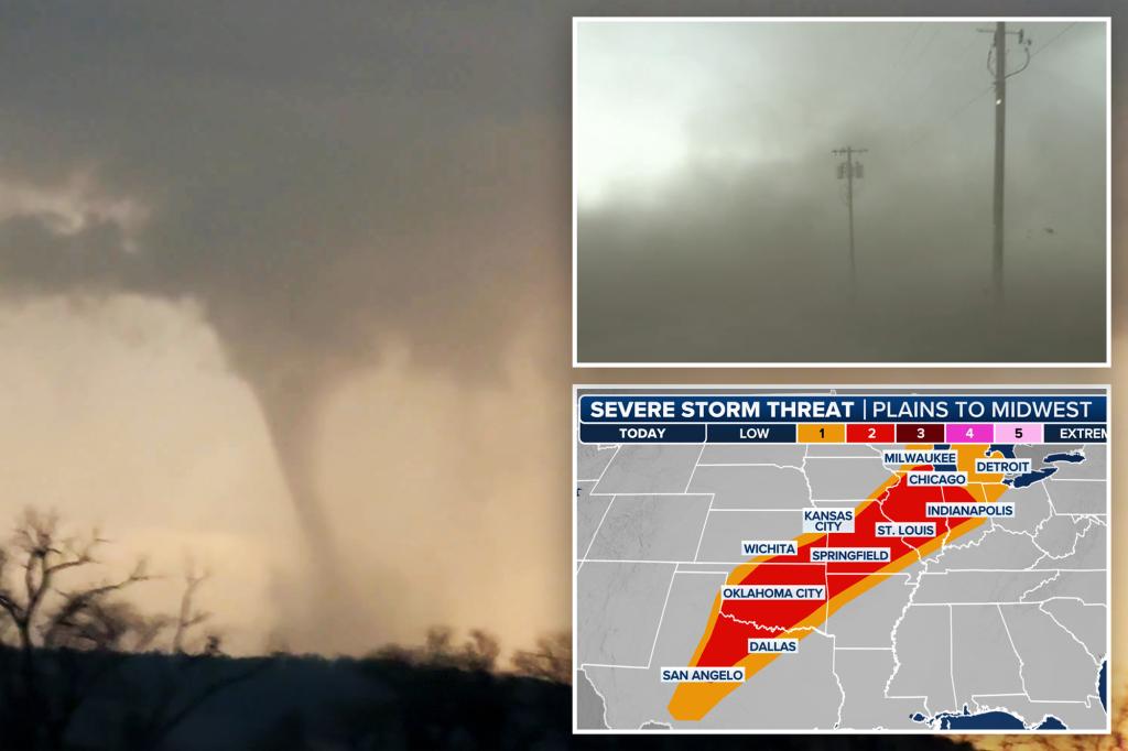
A powerful storm system unleashed a barrage of tornadoes and hurricane-force winds across the Central Plains this week, leaving a trail of destruction in its wake. As the severe weather escalates ahead of Easter weekend, meteorologists warn the system will track eastward, threatening over 50 million Americans from Texas to the Great Lakes. The National Weather Service reports at least 12 confirmed tornadoes since Monday, with wind gusts exceeding 80 mph leveling buildings and knocking out power to thousands.
Communities Grapple With Immediate Aftermath
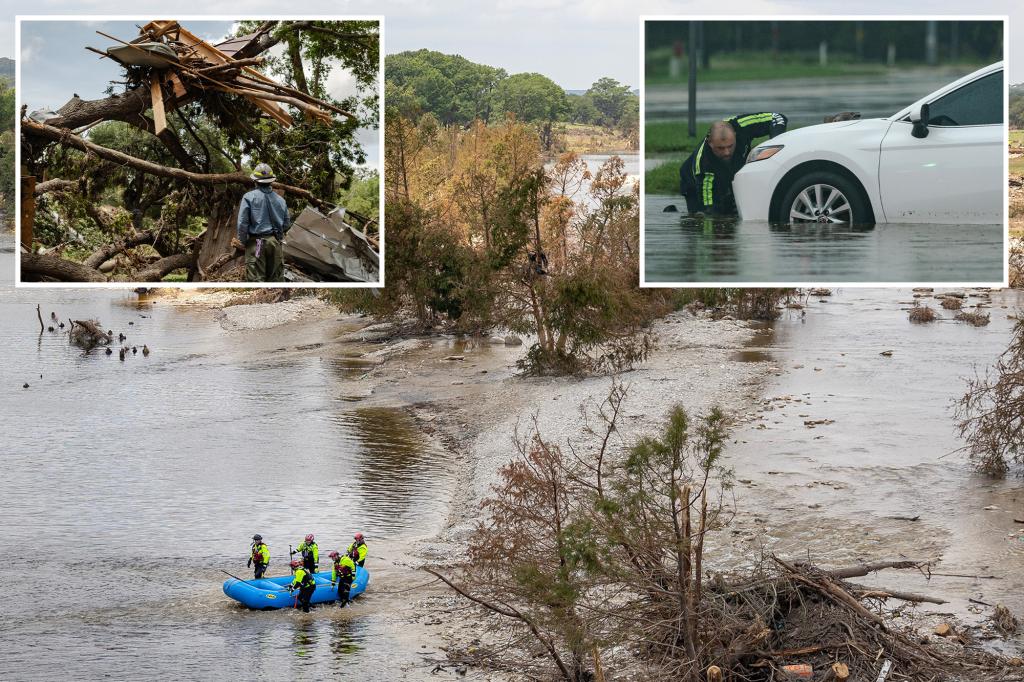
Emergency crews worked through the night in Oklahoma and Kansas where the storms hit hardest. In Custer City, Oklahoma, a EF-2 tornado with 120 mph winds demolished a mobile home park and flipped vehicles like toys. “It sounded like a freight train coming through—then suddenly half my roof was gone,” recounted survivor Marcia Duvall, 62, now staying at a Red Cross shelter.
Key impacts include:
- Over 200 structures damaged across 5 states
- 75,000+ customers without power at peak outage
- 3 confirmed fatalities and 14 serious injuries
- Agricultural losses estimated at $12 million
Meteorologists Trace the Perfect Storm
The violent weather stems from a clash of air masses, where record-warm moisture from the Gulf collided with an unusually strong jet stream dipping south from Canada. “This setup checks every box for explosive storm development,” explained Dr. Evelyn Cho, severe weather researcher at the University of Oklahoma. “We’re seeing wind shear values 30% above seasonal averages, which transforms ordinary thunderstorms into rotating monsters.”
Historical context reveals troubling trends:
- Tornado frequency in the Plains has increased 35% since 2000 (NOAA data)
- Wind damage claims rose 55% nationally over the past decade (Insurance Institute)
- 2024 already ranks in the top 5 years for early-season tornado activity
Eastern States Brace for Escalating Threats
As the low-pressure system reorganizes, forecast models predict:
- Thursday-Friday: Renewed tornado risk for Arkansas/Missouri
- Easter Weekend: Damaging straight-line winds from Ohio to Georgia
- Flood Potential: 4-6 inches of rain expected in Appalachia
“This isn’t just a Plains problem anymore,” warned National Weather Service Director Ken Graham during a press briefing. “We’re particularly concerned about after-dark tornadoes in the Mississippi Valley where people may not hear warnings.” Emergency managers from Illinois to Alabama have pre-positioned swift-water rescue teams and opened emergency operations centers.
Climate Connections Raise Alarm
While scientists caution against attributing single events to climate change, research shows clear patterns. A 2023 study in Nature Geoscience found that warming temperatures:
- Extend tornado season by 2-3 weeks on either end
- Increase the energy available for severe storms by 15%
- Shift the traditional “Tornado Alley” eastward
“What used to be 100-year events are becoming routine,” said climate scientist Dr. Rajiv Patel. “Our infrastructure and warning systems haven’t kept pace with these changes.” Meanwhile, some policymakers argue for better building codes rather than climate debates. “Whether you believe in global warming or not, reinforced safe rooms save lives,” remarked Oklahoma State Senator Greg Trent (R).
Preparation and Recovery Efforts Intensify
With more storms inevitable, experts recommend:
- Downloading weather alert apps with GPS tracking
- Identifying the safest interior room in your home
- Keeping helmets and shoes near beds during warnings
- Documenting property with photos for insurance
Nonprofits like the Salvation Army have mobilized feeding units, while FEMA deployed preliminary damage assessment teams. Insurance adjusters report overwhelming call volumes. “We’re seeing complete roof failures from these winds,” noted Allstate claims supervisor Denise Yang. “Many policies don’t cover flood damage though, so homeowners need to check their coverage now—not after disaster strikes.”
Long-Term Outlook: A New Normal?
The coming months typically bring peak severe weather, and seasonal forecasts suggest above-average activity. Researchers at Colorado State University predict:
- 20% more tornadoes than average through May
- Increased hail larger than 2 inches in diameter
- Prolonged dry spells between heavy rain events
As rebuilding begins in the Plains, the nation watches the eastern horizon. “These storms remind us that nature writes checks humanity can’t cash,” reflected veteran storm chaser Mike Foster. “But being prepared and helping neighbors—that’s how we weather whatever comes next.”
Stay informed: Bookmark the National Weather Service for real-time alerts and follow local emergency management on social media for evacuation orders.
See more Your Daily Weather