Unpacking NOAA’s Bold Predictions for an Active Atlantic Hurricane Season
The National Oceanic and Atmospheric Administration (NOAA) forecasts an exceptionally active 2024 Atlantic hurricane season, predicting 17-25 named storms, including 8-13 hurricanes and 4-7 major hurricanes (Category 3 or higher). This outlook, issued in late May, represents one of the most aggressive preseason forecasts in NOAA’s history, driven by record-warm ocean temperatures and the impending La Niña climate pattern. Coastal communities from Texas to Maine face heightened risks as experts urge immediate preparedness.
Record-Breaking Climate Conditions Fuel Storm Threat
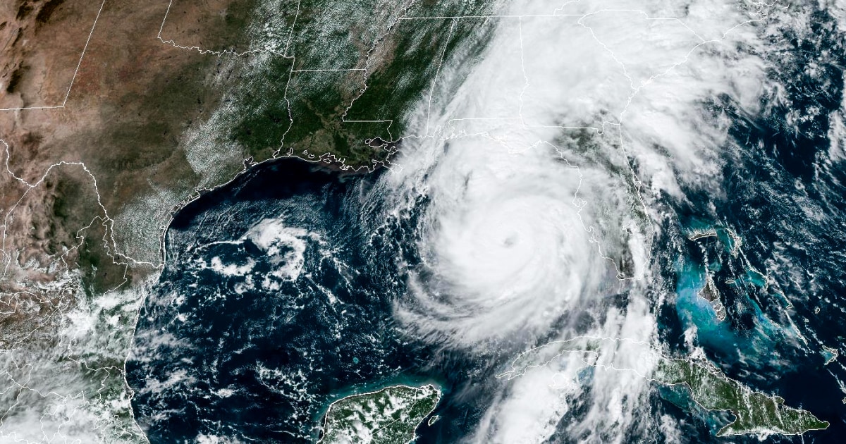
NOAA’s forecast hinges on two unprecedented climate factors converging simultaneously. Sea surface temperatures in the tropical Atlantic reached all-time highs this spring, with some regions measuring 2-3°F above normal. Meanwhile, the rapid transition from El Niño to La Niña conditions removes atmospheric wind shear that typically suppresses hurricane development.
- Ocean heat content: The Main Development Region (10°N-20°N, 60°W-20°W) contains enough thermal energy to sustain multiple intense hurricanes
- Atmospheric patterns: Reduced vertical wind shear and enhanced African easterly waves create ideal storm-forming conditions
- Historical parallels: Similar conditions preceded hyperactive seasons like 2005 (28 storms) and 2020 (30 storms)
“We’re essentially adding rocket fuel to the hurricane engine,” explains Dr. Mark Saunders, lead scientist at University College London’s Tropical Storm Risk Consortium. “The combination of a developing La Niña and Atlantic sea temperatures warmer than we’ve ever recorded at this time of year creates a perfect storm scenario.”
Regional Vulnerabilities and Preparedness Gaps
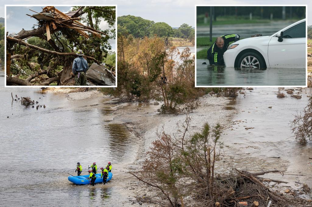
Coastal populations face varying degrees of risk depending on geography and infrastructure. The Gulf Coast remains particularly vulnerable due to:
- Subsiding land elevations in Louisiana and Texas
- Outdated drainage systems in major metro areas like Houston and New Orleans
- Rapid coastal development without commensurate flood protection upgrades
Florida Division of Emergency Management Director Kevin Guthrie warns: “We can’t become complacent because we avoided direct hits last season. Every structure built since Hurricane Ian needs to be reevaluated against these new forecasts. The margin for error has disappeared.”
Meanwhile, northeastern states face growing threats from rapidly intensifying storms that maintain hurricane strength at higher latitudes – a phenomenon linked to climate change. Hurricane Lee’s 2023 brush with New England demonstrated this emerging pattern.
Economic and Insurance Implications
The potential financial consequences of NOAA’s forecast loom large. Munich Re estimates each major hurricane landfall could trigger $20-40 billion in insured losses, with total seasonal costs potentially exceeding $100 billion. The insurance industry has responded with:
- 15-25% premium increases in coastal ZIP codes
- New policy exclusions for wind damage in high-risk areas
- Reduced coverage options for older homes
“We’re seeing insurers retreat from markets faster than homeowners can adapt,” notes insurance analyst Lauren Schultz of Wells Fargo Securities. “The private market can’t shoulder this risk alone – we need innovative public-private solutions before the next catastrophe hits.”
Preparedness Strategies for an Uncertain Season
Emergency managers emphasize that proactive measures can significantly reduce risks. Key recommendations include:
- Home fortification: Install hurricane shutters, reinforce garage doors, and clear drainage systems
- Evacuation planning: Identify multiple routes and destinations accounting for potential traffic jams
- Document protection: Digitize important papers and maintain cloud backups
- Supply kits: Maintain 14 days of food, water, medications, and power alternatives
Technology also offers new protective tools. The National Hurricane Center now provides:
- Potential Storm Surge Flooding Map with neighborhood-level detail
- Experimental “Time of Arrival” tropical storm wind forecasts
- Enhanced cone graphics showing probable impacts rather than just track uncertainty
The Climate Change Connection
While NOAA avoids directly attributing seasonal forecasts to climate change, multiple studies confirm warming’s impact on hurricane behavior. Peer-reviewed research shows:
- 40% increase in the likelihood of storms reaching Category 4/5 strength since 1980
- 20% more rainfall from tropical systems compared to mid-20th century averages
- 50-mile average poleward shift in storm intensification zones since the 1980s
“We’ve moved beyond theoretical models to observable reality,” states Dr. Kerry Emanuel of MIT. “The physics are straightforward – warmer oceans provide more evaporation energy, while a hotter atmosphere holds more moisture. This season could become a case study in climate-amplified extremes.”
Looking Beyond the 2024 Season
Regardless of where storms make landfall, NOAA’s forecast underscores the need for long-term resilience investments. Congress currently debates reauthorization of the National Flood Insurance Program, while FEMA works to implement its 2023 Future of Flood Risk Data initiative. Key pending actions include:
- $2.9 billion in proposed upgrades to the Hurricane and Storm Damage Risk Reduction System
- New building codes requiring elevated foundations in flood zones
- Expansion of natural barriers like oyster reefs and mangrove forests
As hurricane season begins, residents can stay informed through NOAA’s Weather-Ready Nation program and the FEMA app. Remember: preparedness isn’t about predicting the exact path of every storm, but about building capacity to withstand whatever comes our way. Now is the time to act – before the first warning sirens sound.
See more Your Daily Weather