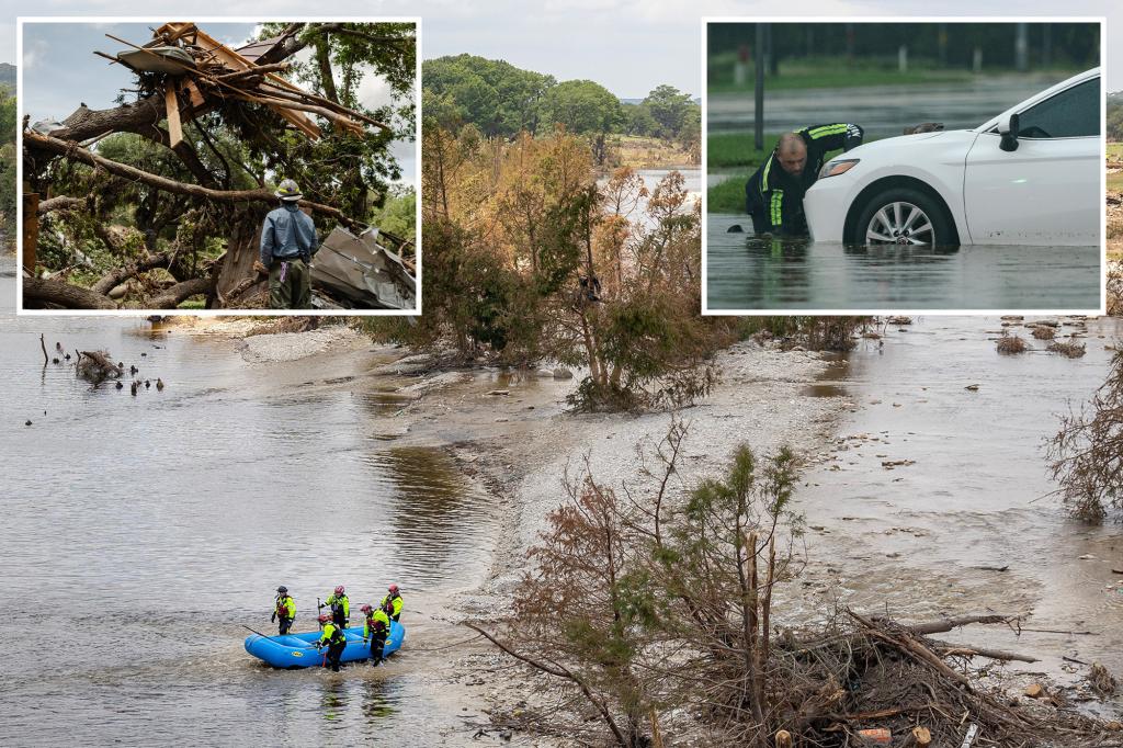
Hurricanes are among nature’s most powerful and destructive phenomena, capable of wreaking havoc on entire regions. Understanding these storms—how they form, intensify, and impact communities—relies on accurate and real-time data. This article explores the intricate process of hurricane data collection, unveiling the secrets behind how scientists gather vital information from within these massive storms to improve forecasting, response strategies, and ultimately, save lives.
Introduction to Hurricane Data Collection
Hurricane data collection is a critical component in understanding and predicting the behavior of these intense storms. By delving into how meteorologists and researchers gather essential data from hurricanes, we can gain insight into their structure, movement, and strength. Accurate data is not only crucial for improving weather forecasts but also plays a key role in preparedness, response, and mitigation efforts.
The Tools of the Trade: Technology Used to Capture Data
Over the years, advances in technology have dramatically enhanced the way scientists collect data from hurricanes. Various methods and tools are deployed to gather information from both the surface and within the storm itself. These include:
- Weather Satellites: These orbiting instruments provide continuous observation of hurricane systems from space, helping track storm formation, movement, and cloud patterns.
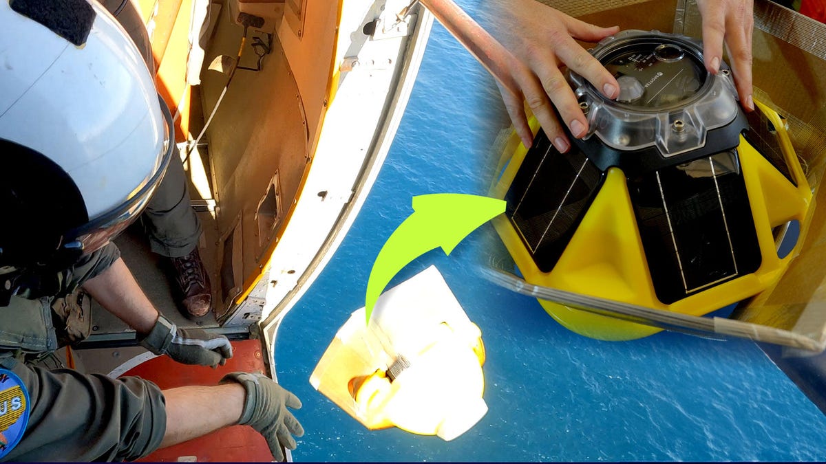
- Reconnaissance Aircraft: Often referred to as “Hurricane Hunter” planes, these specially equipped aircraft fly directly into hurricanes to measure pressure, wind speed, temperature, and humidity at various altitudes. Data from these flights is critical for short-term forecasting.
- Buoys and Weather Stations: These floating devices and land-based stations monitor sea surface temperatures, wave heights, and atmospheric conditions in real-time, providing valuable insights into hurricane behavior.
- Radar Systems: Ground-based radar systems can penetrate the storm’s structure, allowing meteorologists to monitor precipitation rates, wind speed, and even the development of tornadoes within hurricanes.
Gathering Data from the Eye of the Storm
While satellites and radar can provide a broad overview of a hurricane’s activity, direct measurements are invaluable. Reconnaissance aircraft fly directly into the heart of the storm, collecting data from within the hurricane’s eye, eyewall, and outer bands. These areas have drastically different conditions, with the eye often calm and clear, while the eyewall is the most violent part of the storm, where winds are strongest.
During these flights, researchers measure various atmospheric variables such as:
- Air Pressure: Low pressure is an indicator of a hurricane’s intensity. Drops in pressure correlate with the strengthening of a storm.
- Wind Speed: Measuring wind speed at different altitudes helps determine the storm’s intensity and structure.
- Temperature and Humidity: These factors influence the storm’s development and its potential to intensify.
The Role of Data in Hurricane Forecasting
Accurate data is key to improving hurricane forecasting. The National Hurricane Center (NHC) and other meteorological agencies rely heavily on data collected from reconnaissance flights, satellites, and weather stations to develop predictive models. These models simulate a storm’s future path and intensity, helping authorities issue timely warnings and evacuations.
One of the ultimate goals of hurricane data collection is to refine forecasting models. For instance, incorporating real-time data on wind speeds, sea surface temperatures, and pressure gradients allows meteorologists to more accurately predict when a storm will make landfall, its strength at that time, and the likely areas to be impacted.
Advances in Predictive Models
In recent years, improvements in computing power and modeling techniques have made hurricane forecasts more accurate. These advances have been largely driven by the integration of real-time data from multiple sources, including satellites, reconnaissance flights, and weather buoys. Predictive models have become more reliable, providing authorities with more precise forecasts, which can save lives and reduce economic damage.
Furthermore, machine learning algorithms are being employed to analyze vast amounts of historical and real-time data, offering a promising future for even more refined predictions. However, despite these advancements, there remains a degree of uncertainty in forecasting due to the dynamic nature of hurricanes.
Challenges in Data Collection
While the technology behind hurricane data collection has evolved, significant challenges remain. One of the biggest hurdles is the sheer volatility and unpredictability of hurricanes. Storms can intensify rapidly, change direction unexpectedly, and form in regions that are difficult to monitor. These challenges make real-time data collection crucial for staying ahead of the storm.
Another issue is the limitation of coverage in some areas. For example, hurricanes that form in remote parts of the ocean, away from land-based infrastructure, can be difficult to monitor accurately. Satellites and buoys play a vital role, but these methods cannot provide the detailed, localized data that a reconnaissance flight can offer.
The Future of Hurricane Data Collection
Looking to the future, several innovations are on the horizon that could revolutionize hurricane data collection and forecasting. One promising area of development is the use of drones. Small, unmanned aerial vehicles (UAVs) could be deployed to fly into hurricanes, collecting detailed data without the risk to human life. These drones could work in tandem with aircraft to provide even more comprehensive data, especially in areas that are difficult to reach.
Additionally, new satellite missions are being developed to provide even higher-resolution data. The European Space Agency’s Copernicus program, for example, aims to enhance weather monitoring by improving the accuracy of atmospheric and oceanographic measurements. With these advancements, scientists will be able to track storms in real-time with unprecedented accuracy.
Broader Implications of Hurricane Data Collection
Beyond improving forecasting, hurricane data collection has far-reaching implications for climate research, disaster management, and policy. By analyzing trends in hurricane data over time, scientists can study the impact of climate change on storm frequency and intensity. This knowledge is crucial for long-term planning, especially as coastal regions face rising sea levels and more frequent extreme weather events.
For local governments and disaster response agencies, the information gleaned from hurricane data can help optimize evacuation plans, shelter locations, and resource allocation. By understanding a storm’s potential path and intensity, authorities can make informed decisions that minimize loss of life and property damage.
Conclusion: The Ultimate Goal of Hurricane Data Collection
Hurricane data collection is a dynamic and essential field that continues to evolve with technological advancements. As we collect more accurate and detailed information, our ability to predict and understand hurricanes will improve, ultimately reducing the impact of these devastating storms. Through continued innovation, collaboration, and investment in new technologies, we can enhance our preparedness for the next hurricane season, ensuring that we are better equipped to save lives and protect communities from the wrath of nature’s most powerful storms.
See more Your Daily Weather