Unprecedented Weather Patterns Trigger Flood Alerts Across Northeast
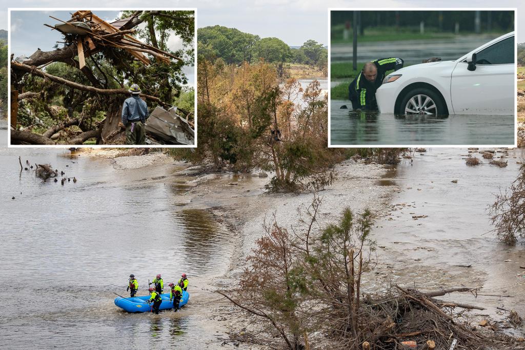
The Northeast United States faces heightened flood risks this week as meteorologists track an unusual convergence of weather systems capable of producing torrential rainfall. Between Tuesday and Friday, coastal areas from New Jersey to Maine may receive 4-8 inches of rain, with isolated totals exceeding 10 inches in urban corridors. The National Weather Service (NWS) has issued flash flood watches for 12 states, warning that saturated ground from recent storms creates dangerous runoff conditions.
Atmospheric Anomalies Defy Seasonal Norms
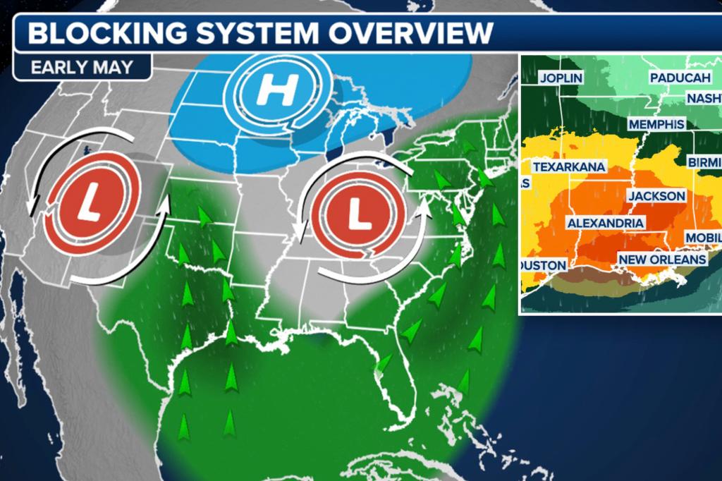
What makes this event remarkable, according to climate specialists, is the collision of three atypical phenomena:
- A stalled low-pressure system drawing tropical moisture northward
- Warmer-than-average sea surface temperatures (2.3°F above normal) fueling precipitation
- A blocking high-pressure system preventing the storm from moving offshore
“We’re essentially seeing a summer-scale rainfall event in what should be a transitional season,” explains Dr. Evelyn Cho, senior climatologist at Columbia University’s Lamont-Doherty Earth Observatory. “The rainfall intensity models are showing patterns we’d typically associate with August hurricanes, not mid-autumn systems.”
Urban Infrastructure Under Stress
Major metropolitan areas face particular vulnerability due to aging drainage systems. An EPA report from 2022 found:
- 43% of Northeast stormwater infrastructure is operating beyond designed capacity
- New York City’s sewer system can handle only 1.75 inches of rain per hour
- Boston’s flood mitigation systems are rated for 50-year events, not current 100-year projections
“This isn’t just about rainfall totals—it’s about rainfall rates,” warns FEMA Regional Director Carlos Mendez. “When 3 inches falls in 90 minutes, even the best systems get overwhelmed. We’re urging municipalities to prestage pumps in known trouble spots.”
Economic and Human Impacts Loom Large
The potential consequences extend far beyond flooded basements. Analysts predict:
- $300-500 million in immediate property damage if predictions hold
- Major disruptions to Amtrak’s Northeast Corridor service
- Possible contamination events as combined sewer overflows discharge into waterways
Small business owners like Providence restaurateur Lina Patel express mounting anxiety. “After the 2010 floods ruined our inventory, we installed floodgates,” she says. “But the city’s own projections show water levels could top those barriers by six inches this time.”
Climate Change Connections Emerge
While no single weather event can be directly attributed to climate change, researchers note disturbing trends:
- The Northeast has seen a 55% increase in heavy precipitation events since 1958
- NOAA data shows the region’s wettest 1% of days now deliver 55% more rain than in 2000
- Sea level rise of 9 inches since 1950 worsens coastal flooding impacts
“We’ve moved beyond theoretical models into observable reality,” states MIT atmospheric science professor Dr. Rajiv Singh. “What were once 100-year flood plains now flood every decade. This week’s event fits the pattern of intensified hydrological cycles.”
Preparedness Measures and Response Strategies
Emergency management officials recommend these immediate actions:
- Clear storm drains of autumn leaf debris
- Document property with photos for insurance claims
- Prepare evacuation kits with medications and critical documents
Utility companies have activated mutual aid agreements, with 1,200 additional line workers positioned from Pennsylvania to New Hampshire. “We learned from Superstorm Sandy that prepositioning resources saves lives,” says Con Edison emergency preparedness manager Diane Kowalski.
Long-Term Adaptation Challenges
The current crisis spotlights deeper infrastructure dilemmas:
- 98% of Northeast flood control systems were designed using 20th-century rainfall data
- Zoning laws in many communities still allow development in high-risk areas
- Only 17% of at-risk homeowners carry flood insurance
Regional planners emphasize the need for green infrastructure solutions. “We can’t just engineer our way out with bigger pipes,” notes Boston Chief Resilience Officer Kate McDonough. “Rain gardens, permeable pavement, and wetland restoration must become standard practice.”
What Comes Next: Monitoring and Recovery
As the system develops, meteorologists will watch these critical indicators:
- Storm track shifts that could concentrate rainfall in narrower bands
- Potential for embedded thunderstorms to produce localized deluges
- Tidal conditions that may impede drainage during peak rainfall periods
Residents are advised to monitor NWS updates and heed evacuation orders without delay. “Floodwaters rise faster than people realize,” cautions Mendez. “Six inches of moving water can knock an adult off their feet. Two feet will float most vehicles.”
The coming days will test both the region’s emergency response systems and its capacity to confront a changing climate reality. As Cho soberly observes, “These unprecedented events are becoming precedents. How we respond now sets the template for decades to come.”
See more Your Daily Weather