Southern Plains Brace for Severe Weather: Tornadoes and Hail Threaten Communities
Residents across the Southern Plains are preparing for a dangerous outbreak of severe weather, including potential tornadoes and hail the size of tennis balls, as a powerful storm system sweeps through the region. Meteorologists warn that the storms, expected to intensify through the evening, could cause significant disruptions and damage. Authorities urge communities in Texas, Oklahoma, and Kansas to stay alert and take immediate safety precautions.
Meteorologists Issue Urgent Warnings
The National Weather Service (NWS) has upgraded its severe weather alerts, highlighting a high-risk zone stretching from northern Texas to central Oklahoma. “This is a particularly volatile setup,” said Dr. Laura Simmons, a senior meteorologist at the Storm Prediction Center. “We’re looking at supercell thunderstorms capable of producing long-track tornadoes and destructive hail.”
Key risks identified by the NWS include:
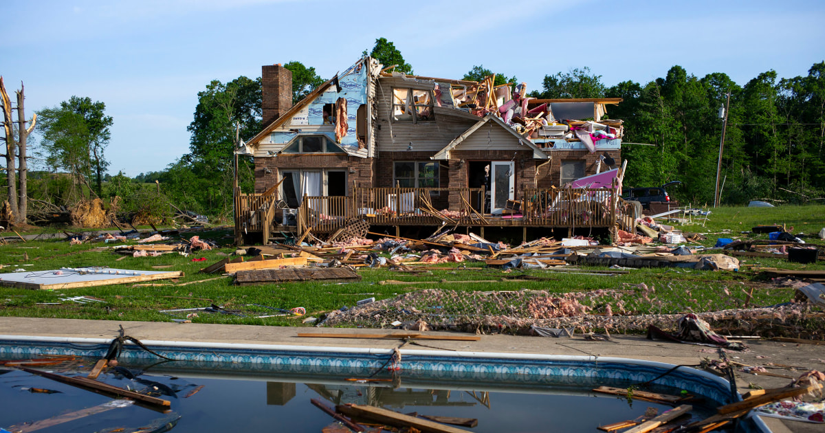
- Tornadoes: EF-2 or stronger possible, with wind speeds exceeding 110 mph
- Hail: Up to 2.5 inches in diameter, potentially damaging vehicles and structures
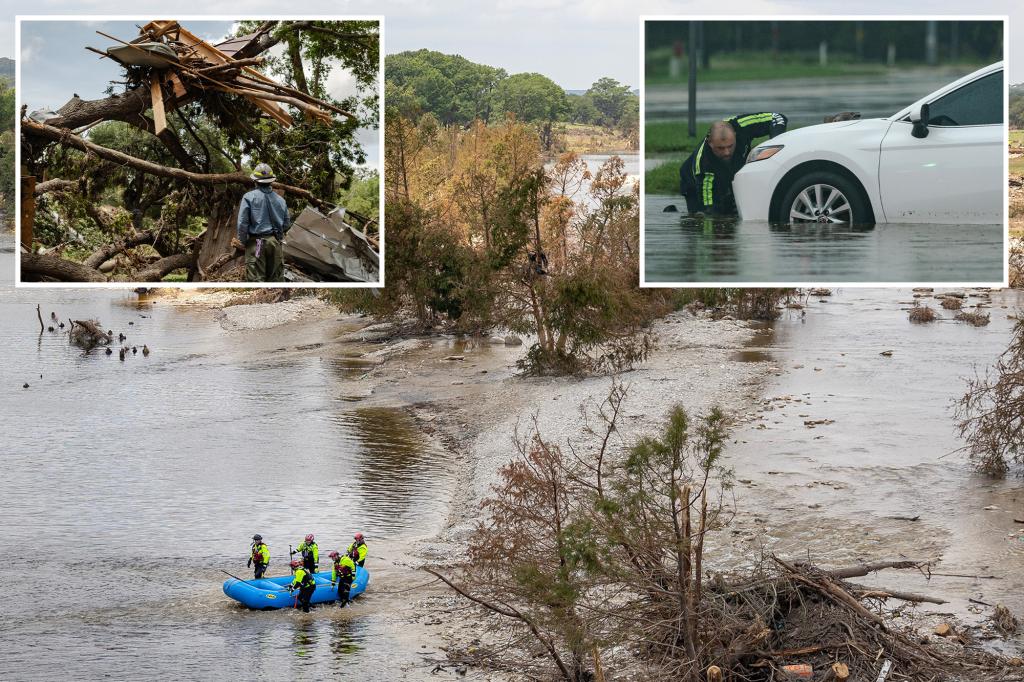
- Flash Flooding: Rainfall rates of 2-3 inches per hour in localized areas
Communities Prepare for Impact
Local emergency management teams have activated storm response protocols, opening shelters and pre-positioning rescue crews. In Oklahoma City, schools dismissed students early, while hospitals canceled non-essential procedures. “We learned hard lessons from past outbreaks,” said Tulsa Emergency Manager Carlos Mendez. “Every minute of advance preparation saves lives when seconds count.”
Residents are taking varied approaches to the threat:
- Some families are reinforcing storm shelters with additional supplies
- Business owners are installing protective coverings on windows
- Farmers are moving livestock to lower-lying areas less prone to tornado damage
The Science Behind the Storm System
The severe weather stems from a clash of air masses, with warm, moist Gulf air colliding with a strong cold front from the Rockies. Atmospheric conditions show:
- CAPE (Convective Available Potential Energy) values exceeding 3,500 J/kg
- Wind shear measurements indicating high tornado potential
- Lifted Index values below -10, suggesting extreme instability
“These parameters create what we call a ‘loaded gun’ scenario,” explained atmospheric scientist Dr. Evan Pritchard of the University of Oklahoma. “All it takes is one trigger mechanism to release that energy violently.”
Economic and Infrastructure Concerns
The storm threat comes at a sensitive time for regional agriculture, with wheat crops nearing harvest. Hail of the predicted size could devastate thousands of acres. Energy companies are also monitoring the situation closely, as the region contains critical oil and gas infrastructure.
Potential impacts include:
- Crop losses exceeding $100 million if hail hits agricultural areas
- Power outages affecting up to 500,000 customers based on similar past events
- Transportation delays as highways may close due to flooding or debris
Safety Recommendations from Experts
Emergency officials emphasize these protective measures:
- Identify and practice routes to the nearest storm shelter
- Keep phones charged and enable wireless emergency alerts
- Avoid traveling during peak storm hours (4 PM to midnight local time)
“Don’t wait to see rotation before taking action,” warned NWS meteorologist Simone Carter. “By the time you hear the freight train sound, it may be too late to reach safety.”
Long-Term Climate Connections
This outbreak continues an active severe weather season, with tornado counts running 25% above the 10-year average. Climate researchers note that warming Gulf waters may be contributing to increased moisture availability, potentially intensifying spring storm systems.
Looking ahead, forecast models suggest:
- Another severe weather episode possible in 5-7 days
- An earlier-than-normal start to summer storm patterns
- Increased volatility in traditional tornado alley regions
Staying Informed and Taking Action
As the situation develops, residents should monitor updates from trusted sources like the NWS website and local emergency broadcasts. Community organizations are offering free weather radio programming for vulnerable populations.
For those seeking to help, the Red Cross is recruiting volunteers for storm response teams. Visit their website to learn how you can assist with relief efforts in your area.
The coming hours will test the region’s preparedness systems, but officials express confidence in the coordinated response. “We’ve trained for this,” said Oklahoma Governor’s Office spokesperson Maria Juarez. “Now we need everyone to do their part and heed the warnings.”
See more Your Daily Weather