Millions Bracing for Severe Weather: East Coast Faces Widespread Alerts
Over 25 million Americans along the East Coast are under severe weather alerts as meteorologists warn of potentially life-threatening storms. From Florida to Maine, residents face a multi-hazard threat including torrential rains, damaging winds, and possible tornadoes through the weekend. Authorities urge immediate preparedness as the system intensifies, with peak impacts expected within 48 hours.
The Scope of the Impending Storm System
The National Weather Service (NWS) has issued alerts spanning 14 states, with the Mid-Atlantic region facing the highest risk. Weather models predict:
- Rainfall exceeding 6 inches in 24-hour periods
- Sustained winds of 40-60 mph with higher gusts
- Isolated tornado potential in coastal areas
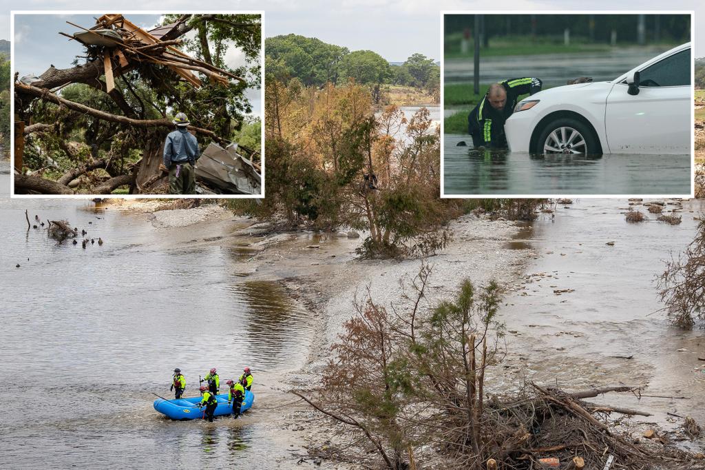
- Widespread flash flooding concerns
“This is a classic nor’easter developing with tropical moisture infusion,” explains Dr. Elena Rodriguez, senior meteorologist at the Weather Prediction Center. “What makes this system particularly dangerous is its slow movement—some communities could experience continuous severe conditions for 18-36 hours.”
Regional Impact Breakdown
The storm’s effects will vary significantly by location:
Northeastern Urban Corridor
Major cities including New York, Philadelphia, and Boston face transportation disruptions. Subway systems are preparing contingency plans, while airports have already canceled 1,200+ flights. Coastal flood warnings extend from Chesapeake Bay to Cape Cod, with 2-4 foot storm surges predicted.
Southeastern States
The threat shifts to tornado formation in North Carolina and Virginia, where the Storm Prediction Center has issued a Level 3 (Enhanced) risk. Rural communities remain particularly vulnerable due to limited warning systems and mobile home concentrations.
Preparedness Measures and Emergency Response
Emergency management agencies have activated crisis protocols across affected states. Key recommendations include:
- Charging all electronic devices before the storm
- Securing outdoor furniture and loose objects
- Identifying the safest interior room for shelter
- Preparing 72-hour emergency kits with medications
“We’re coordinating with National Guard units for rapid response deployment,” says FEMA Regional Director Mark Thompson. “The lesson from past events like Hurricane Sandy is that overpreparation saves lives when minutes count.”
Climate Change Connections
Scientists note this event fits concerning patterns:
- 30% increase in extreme precipitation events since 1950
- Nor’easters now deliver 10% more rainfall on average
- Coastal flood frequency has doubled in 20 years
Dr. Alicia Chen, climate researcher at Columbia University, observes: “Warmer ocean temperatures are essentially turbocharging these storm systems. What were once 50-year events now occur every decade.”
Economic and Infrastructure Concerns
The storm threatens significant economic disruption:
- Potential $500M-$1B in insured losses
- Critical supply chain vulnerabilities for fuel and groceries
- Aging power infrastructure at risk of prolonged outages
Energy companies have positioned repair crews strategically, while hospitals are implementing generator tests. “Our biggest worry is cascading failures if flooding impacts substations,” cautions Dominion Energy spokesperson Rachel Goldstein.
Long-Term Implications and Next Steps
As climate patterns evolve, experts emphasize the need for:
- Updated flood zone mapping
- Strengthened building codes
- Community resilience programs
- Early warning system investments
Residents should monitor local emergency alerts and avoid travel during peak storm conditions. The Red Cross encourages blood donations now to offset anticipated shortages. With proper precautions, communities can weather this system safely—but vigilance remains critical as new data emerges.
Stay informed: Bookmark the National Weather Service website for real-time updates and verify information through official sources only.
See more Your Daily Weather