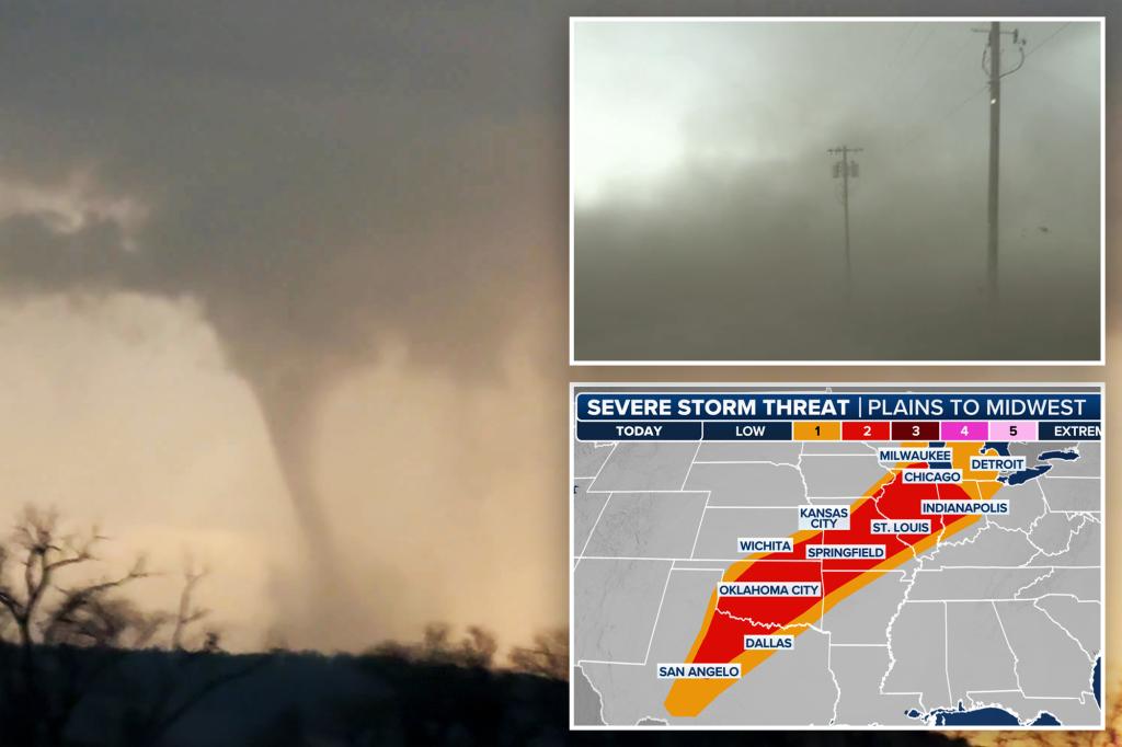
Cyclone Errol Shows Signs of Weakening Off Western Australia
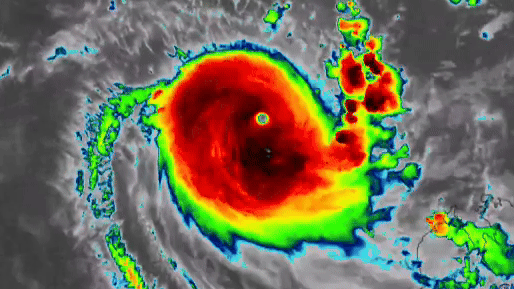
Perth, Western Australia – Cyclone Errol, the intense tropical storm churning off Western Australia’s northwest coast, has begun showing early signs of weakening, according to meteorologists. The system, which reached category 3 intensity earlier this week, now displays reduced wind speeds and a less organized structure as it moves through cooler waters. While still posing risks to coastal communities, experts suggest the cyclone may continue losing strength over the coming days.
Meteorological Observations Track Errol’s Changing Intensity
The Bureau of Meteorology (BoM) reported sustained winds decreasing from 120 km/h to 95 km/h within a 24-hour period, with atmospheric pressure rising steadily—a key indicator of weakening cyclonic activity. Satellite imagery reveals the storm’s eye becoming less defined, while sea surface temperatures along its path have dropped below the 26.5°C threshold needed to sustain tropical cyclone intensity.
“We’re observing classic decay signals,” said Dr. Rebecca Tan, senior climatologist at the University of Western Australia. “The combination of cooler ocean temperatures, increased wind shear, and dry air intrusion suggests Errol will continue downgrading, potentially to tropical storm status within 48 hours.”
Key data points marking Errol’s decline:
- Central pressure increased from 965 hPa to 980 hPa in 36 hours
- Convective activity reduced by 40% compared to peak intensity
- Storm diameter expanded by 15%, indicating energy dispersion
Coastal Communities Remain Cautious Despite Positive Signs
Emergency services maintain watch along the Pilbara and Gascoyne coasts, where Errol’s outer bands could still deliver damaging winds exceeding 90 km/h and heavy rainfall. The Department of Fire and Emergency Services (DFES) has issued yellow alerts for coastal areas between Onslow and Exmouth, advising residents to:
- Secure loose outdoor items
- Prepare emergency kits with 72 hours of supplies
- Monitor official BoM updates every three hours
“We can’t become complacent just because the system is weakening,” warned DFES Commissioner Darren Klemm. “Remnant cyclones often bring unpredictable rainfall patterns that can cause flash flooding hundreds of kilometers from the center.” Historical data supports this caution—in 2018, Cyclone Joyce weakened rapidly but still dropped 300mm of rain in 24 hours across the Mid West region.
Climate Patterns Influencing Errol’s Behavior
Meteorologists attribute Errol’s formation and subsequent weakening to competing climate drivers. The storm initially intensified under the influence of a Madden-Julian Oscillation (MJO) pulse moving through the Indian Ocean, but now faces unfavorable conditions caused by:
- A strengthening high-pressure ridge to the south
- Cooler-than-average sea temperatures from the Ningaloo Niño effect
- Upper-level wind patterns disrupting the storm’s vertical structure
Dr. Marcus Yi, a cyclone researcher at CSIRO, notes: “This reflects our climate models’ predictions for the season—more frequent cyclone formations but shorter lifespans due to competing atmospheric influences. Since 2020, we’ve observed a 15% increase in early-stage cyclones that fail to reach peak intensity.”
Economic and Environmental Impacts
The shipping and offshore energy industries have begun cautiously resuming operations after temporary shutdowns. Woodside Petroleum reported no damage to its Pluto LNG facility but maintained reduced staffing levels as a precaution. Meanwhile, marine biologists express concern about potential coral damage from stirred-up sediments along the Ningaloo Reef.
Tourism operators face mixed consequences. While cyclone warnings led to cancellations in Exmouth, some adventure companies report increased interest in “storm chasing” tours. “There’s growing demand for extreme weather tourism,” noted Leah Morrison of Coral Coast Adventures. “We’re getting inquiries from photographers and scientists wanting to document the cyclone’s effects.”
Future Outlook and Climate Considerations
As Cyclone Errol continues its southwestward track away from populated areas, attention turns to broader climate patterns. The Indian Ocean Dipole (IOD) remains in a neutral phase, suggesting average cyclone activity for the remainder of the season. However, researchers caution that warming ocean temperatures could alter traditional cyclone behaviors in coming decades.
“What we’re seeing with Errol—rapid intensification followed by quick decay—may become more common,” explained Dr. Tan. “Our models suggest climate change could increase cyclone volatility by up to 30% in this region by 2050.”
Residents and businesses along Australia’s northwest coast can stay updated through the Bureau of Meteorology’s cyclone tracker, while emergency preparedness information remains available via the DFES website. Though Cyclone Errol appears to be fading, experts emphasize the importance of maintaining cyclone readiness throughout the season, which typically runs until April 30.
See more Your Daily Weather