East Coast Storm Unleashes Potential Flash Floods: What You Need to Know
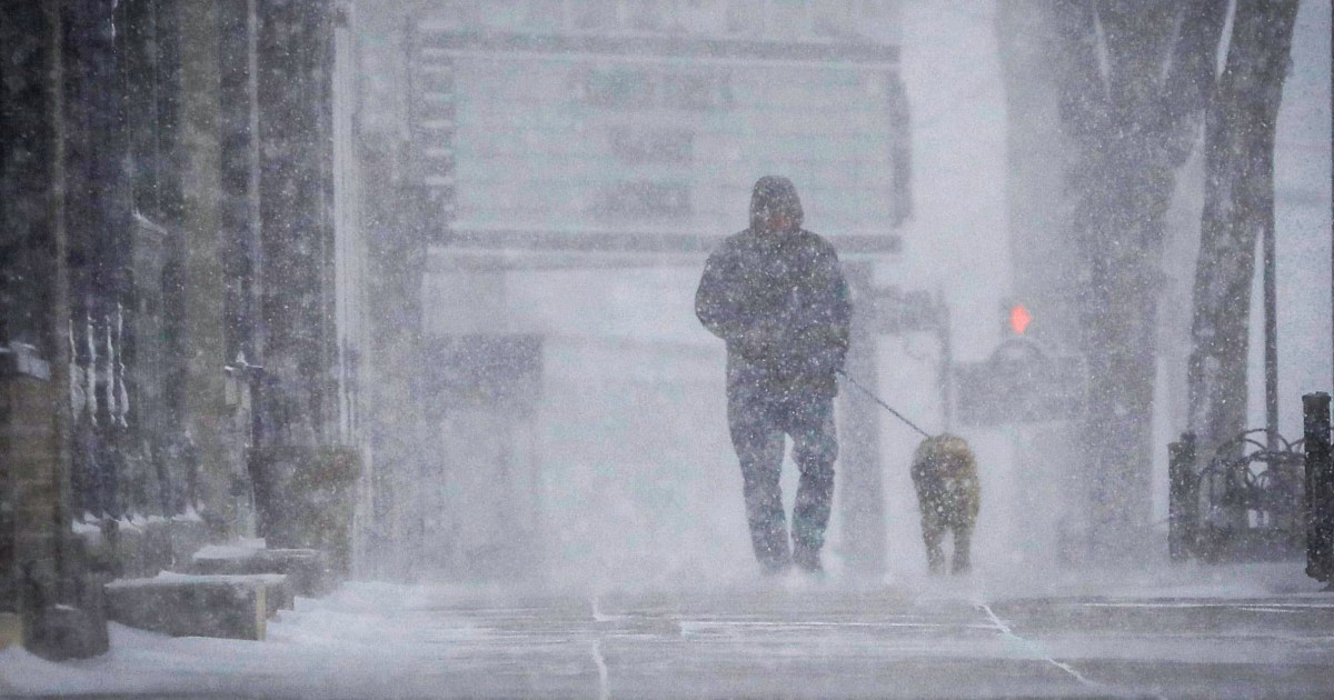
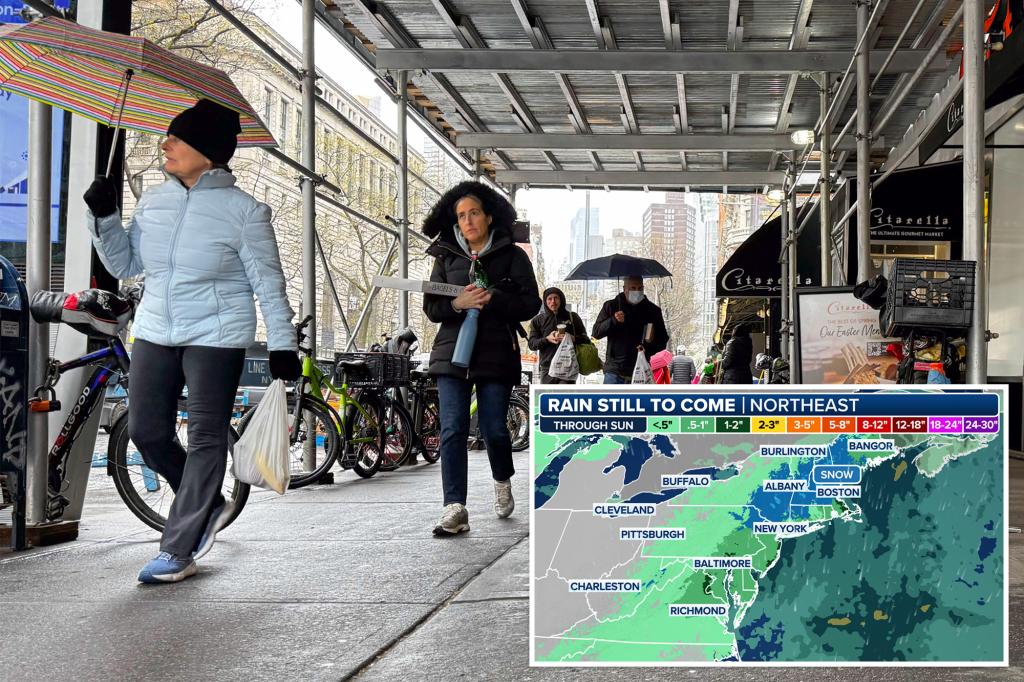
A powerful coastal storm is expected to batter the East Coast this week, threatening over 14 million residents along the I-95 corridor with flash floods, heavy rainfall, and hazardous travel conditions. Meteorologists warn the system could drop 4-8 inches of rain in some areas between Wednesday and Friday, overwhelming drainage systems and triggering rapid-onset flooding. Emergency management officials urge residents from Virginia to Massachusetts to prepare for potential evacuations and power outages.
Meteorological Conditions Fueling the Threat
The approaching storm results from a collision of three key factors: a deep low-pressure system tracking up the coast, a surge of tropical moisture from the Atlantic, and a stalled frontal boundary acting like a conveyor belt for precipitation. The National Weather Service (NSW) has issued Flash Flood Watches for 12 states, noting some areas could see rainfall rates exceeding 2 inches per hour.
“This setup checks all the boxes for a high-impact flooding event,” explains Dr. Lisa Chen, senior meteorologist at the Weather Prediction Center. “The combination of saturated ground from recent rains and the expected intensity of this system creates a perfect storm scenario for flash flooding in urban areas.”
Key risk factors include:
- Soil saturation levels at 90-100% capacity across the mid-Atlantic
- Antecedent rainfall 200% above normal for September
- Storm duration exceeding 36 hours in most locations
High-Risk Areas and Projected Impacts
The storm’s impacts will vary by region, but forecast models consistently highlight several danger zones. Low-lying urban areas with aging infrastructure—particularly Baltimore, Philadelphia, and Providence—face the greatest flood risks. The NSW’s experimental Flood Severity Index shows:
- Major Risk (Level 3-4): Coastal New Jersey, Delaware Valley, Chesapeake Bay communities
- Moderate Risk (Level 2): Boston metro area, Hudson Valley, eastern Pennsylvania
- Limited Risk (Level 1): Inland areas beyond 50 miles from the coast
Transportation networks will likely bear the brunt of the disruption. Amtrak has already announced modified schedules for Northeast Regional routes, while major airports are preparing for cascading delays. “We’re looking at the potential for 12-18 hour travel nightmares on Thursday,” says transportation analyst Mark Reynolds. “When you combine flooded roads with probable rail suspensions, this could become one of the worst commute days in recent memory.”
Emergency Preparedness Recommendations
Local governments have activated emergency operations centers and prepositioned high-water rescue vehicles in anticipated trouble spots. However, officials stress individual preparedness remains crucial. FEMA Regional Director Carla Mendez advises residents to:
- Document property with photos/video for insurance purposes
- Charge all devices and backup power banks
- Identify evacuation routes that avoid known flood zones
- Prepare 3 days of medications and supplies
Businesses aren’t exempt from the threat either. The U.S. Chamber of Commerce estimates a single day of severe flooding along the I-95 corridor could cost the economy over $2.3 billion in lost productivity and damage. Many corporations have activated continuity plans, with several major employers announcing preemptive office closures.
Climate Change Connections and Future Risks
While individual weather events can’t be directly attributed to climate change, scientists note this storm fits established patterns of intensifying East Coast precipitation. Research from NOAA shows:
- Heavy rainfall events have increased 55% in the Northeast since 1958
- The Atlantic seaboard experiences 30% more extreme precipitation days than in the 20th century
- Sea level rise of 4-8 inches since 1950 exacerbates coastal flooding
“What used to be 50-year flood events are now occurring every 5-10 years in some communities,” notes climate researcher Dr. Evan Park. “This acceleration demands fundamental changes in how we design drainage systems and enforce zoning regulations.”
Staying Safe During the Storm
As the system approaches, residents should monitor local emergency alerts and avoid nonessential travel once heavy rains begin. Remember:
- Never drive through flooded roadways—just 12 inches of water can float most vehicles
- Seek higher ground immediately if flash flooding warnings are issued
- Report downed power lines to utility companies (never approach them)
- Check on vulnerable neighbors when safe to do so
The storm’s aftermath may bring additional challenges, including water contamination and mold risks in flooded structures. Public health officials warn that 48% of flood-related injuries occur during cleanup activities, emphasizing the need for proper protective equipment.
Looking Beyond the Current Crisis
While immediate safety concerns take priority, this event underscores broader questions about infrastructure resilience in the climate era. Congress currently debates a $14 billion flood mitigation package that would fund projects like upgraded stormwater systems and buyouts for repeatedly flooded properties.
For now, East Coast residents should bookmark their state’s emergency management website and sign up for wireless emergency alerts. As the climate continues changing, weather literacy and preparedness become not just useful skills—but essential ones for coastal living. Stay tuned to trusted local news sources for real-time updates as this dangerous storm develops.
See more Your Daily Weather