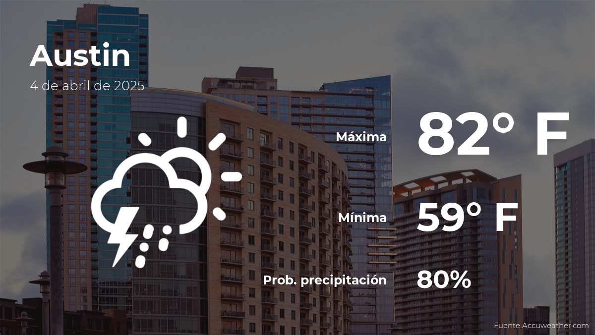
Today’s Weather in Austin: A Mixed Bag of Sun and Showers
Residents of Austin should prepare for a partly cloudy Friday, April 4th, with temperatures peaking near 78°F and a 30% chance of scattered afternoon showers. The National Weather Service (NWS) predicts mild humidity at 65%, while winds from the southeast will gust up to 12 mph. Morning commuters can expect clear skies, but outdoor plans may require backup options as rain could arrive by late afternoon.
Detailed Forecast Breakdown
The day will begin with comfortable conditions, as dawn temperatures hover around 62°F. By midday, clouds will gradually build, though sunshine will still dominate. “This is typical for early April in Central Texas,” says meteorologist Lisa Chen of the NWS Austin/San Antonio office. “The clash between warm Gulf air and cooler northern fronts creates these unpredictable patterns.”
Key weather markers for April 4th:
- Sunrise/Sunset: 7:12 AM / 7:45 PM CDT
- UV Index: 7 (High) – sunscreen recommended
- Rainfall Potential: 0.1-0.3 inches if showers develop
- Pollen Count: Moderate (Oak, Ash, Mulberry)
How the Weather Could Impact Your Plans
Event organizers are monitoring conditions closely. The Austin Parks Department has moved forward with the weekly “Blues on the Green” concert at Zilker Park but advises attendees to bring rain jackets. Meanwhile, construction crews are racing to complete roofing projects before any potential showers hit.
“We’re seeing more of these quick-developing pop-up showers compared to last April,” notes local climatologist Dr. Raj Patel. His research shows a 15% increase in April precipitation variability since 2015, aligning with broader climate change models for the region.
Comparing Regional Weather Patterns
While Austin faces uncertain conditions, neighboring areas tell different stories:
- San Antonio: 20% higher rain probability due to southerly position
- Dallas-Fort Worth: Clear skies but cooler at 72°F maximum
- Houston: Storms likely, with flood watches in low-lying areas
The Texas A&M Climate Observatory attributes these disparities to a “ridge-and-trough” pattern dominating the southern plains this week. Their atmospheric pressure maps show Austin sitting precisely at the boundary between competing weather systems.
Weekend Outlook and Long-Term Trends
Friday’s weather serves as a prelude to more stable conditions. The weekend promises sunnier skies with highs reaching 82°F by Sunday. However, the NWS 8-14 day outlook suggests another rain system could arrive mid-month, potentially affecting the Austin FC home game on April 13th.
For those tracking seasonal shifts, April 2024 continues the trend of warmer nights (+2.1°F above the 1991-2020 average) but with preserved daytime highs—a signature of urban heat island effects meeting changing precipitation cycles.
Preparing for Austin’s Variable Weather
Smart preparation involves:
- Layering clothing for 10-15° morning-to-afternoon swings
- Checking radar updates via reliable apps like MyRadar or Weather Underground
- Securing outdoor furniture in case of gusty winds
“Don’t let the morning sun fool you,” warns emergency management coordinator Sarah Williamson. “We’ve responded to multiple weather-related incidents this season where people underestimated how quickly conditions change.”
As climate patterns evolve, Austinites might need to become accustomed to these meteorological mood swings. The city’s Office of Sustainability is currently developing new weather preparedness guides, set for release before the 2024 hurricane season.
Stay weather-aware by bookmarking the NWS Austin/San Antonio page for real-time updates and safety alerts.
See more Your Daily Weather


